
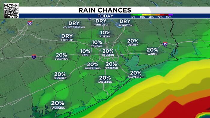
Monday’s forecast:
Drier air and sunshine will return this week, however, there is a small chance to see some additional afternoon spotty showers making some roads wet. Most of the area will be dry and less humid with highs in the mid 80s.

We’ve been teased with four cold fronts late summer into early fall. All of them have stalled to the north of Houston so far. But the one late Monday into Tuesday looks like it is moving all the way through southeast Texas. It isn’t a strong front in terms of temperature, but it will bring low humidity, sunny skies, and cool mornings in the 60s. We’ve been waiting a long time for this.

Tracking the tropics:
The latest update from the NHC has placed a high chance of formation on this disturbance in the southern Gulf. This cluster will likely become a tropical depression later this week. Early models generally pull it away from the Texas coast so nothing to worry about for now but we’ll keep our eyes on it.

So far this hurricane season we’ve had eight tropical storms. We have not had a hurricane in the Atlantic basin. The latest first hurricane to form was Gustav and Humberto, which formed on September 11th. This means our 2026 hurricane season set a record for the latest hurricane to form.

Drier air and warm temps return this week, but it will feel nicer! Sunny skies will take over until midweek. By Friday, some shower and storm chances could return, especially along the coast.


